Missouri is full of places that did not exactly die. They were flooded, bought out, bulldozed, moved, poisoned, fenced off, paved over, or quietly outgrown by the next town down the road.
That makes the state’s abandoned towns more interesting than the usual “old buildings in the weeds” ghost-town story.
Some of these places are still visitable. Some are hidden inside military land. Some are under Lake of the Ozarks. Others survive mostly as cemeteries, trail names, old maps, and family stories.
And a few disappeared for reasons so dramatic they still feel hard to believe.
1. Times Beach: The Missouri Town Erased by Dioxin

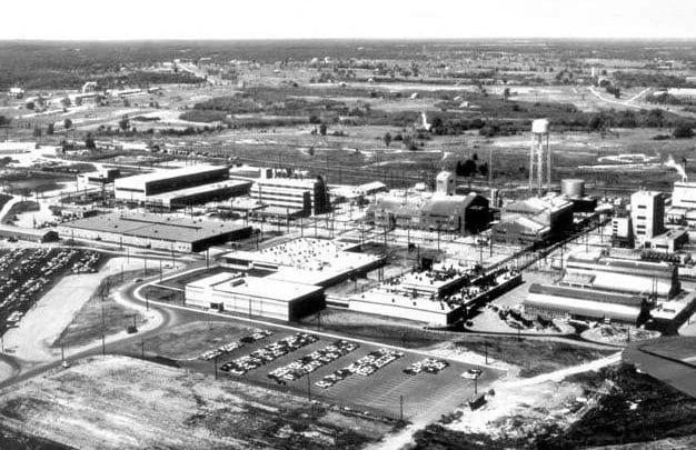
Times Beach may be the most infamous abandoned town in Missouri.
It was not a worn-out mining camp or a forgotten river landing. It was a real modern community along the Meramec River near old Route 66, with more than 2,000 residents in the early 1980s. People lived there, raised families there, and expected it to keep being a town.

Then came the dioxin disaster.
In the 1970s, waste oil contaminated with dioxin was sprayed on roads to control dust. For a while, nobody understood the full danger sitting in the dirt. By the early 1980s, the contamination had become a national environmental story.

The town was evacuated. The federal government bought out the residents. Houses and businesses came down. Times Beach stopped being a town.
Today, the former townsite is part of a public park landscape. The streets, homes, and local life are gone.

That is what makes Times Beach so unsettling. It vanished within living memory, not because people lost interest, but because the ground itself became dangerous.
This is not a “wander through the ruins” kind of place. Its ghost is in the absence. A whole town was there, and then it was not.

More Info: Route 66 Park Official Website
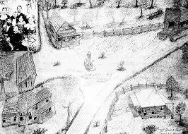
2. Bloodland, Cookville, and Palace: The Towns Swallowed by Fort Leonard Wood
Several Missouri towns disappeared not because they failed, but because the federal government needed the land.

Bloodland, Cookville, and Palace were all Pulaski County communities that got caught in the creation of Fort Leonard Wood during the World War II buildup.
Before the Army arrived, this part of the Ozarks held farms, schools, post offices, churches, cemeteries, creek roads, and small service communities.
Then national defense changed everything.
The War Department acquired the land in 1940 and 1941. Families had to leave. Roads were altered or closed. Ordinary rural settlements were folded into a military training installation.
Bloodland

Bloodland is the one that grabs attention first, if only because of the name.
It sounds like a place from a dime-store horror novel, but it was a real community in western Piney Township. Its name is traced to a Mr. Blood, not some grisly legend. The town had a post office by the late 1800s and a school that served nearby families.
After Fort Leonard Wood was established, Bloodland disappeared as a lived-in place. Today, the name survives more strongly than the town itself.
Cookville

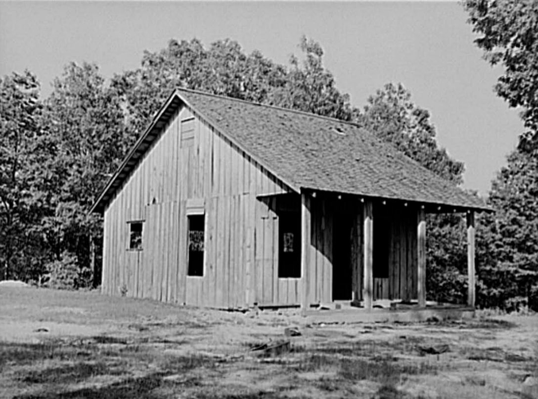
Cookville had the classic bones of a rural Missouri settlement: a creek, a store, a mill, and a post office.
It sat along Roubidoux Creek and served families in the surrounding countryside. Places like Cookville mattered because rural life depended on little local hubs. A post office and mill could save people hours of travel.
When Fort Leonard Wood absorbed the area, Cookville’s reason for existing ended.
More on Cookeville, and where I found these photos: https://www.oldstagecoachstop.org/webgeezer/Gazette10/cookville.pdf
Palace
Palace is especially interesting because it still had a pulse in the 1930s.
Records connect it with a school, a post office, and nearby Civilian Conservation Corps activity. It was not some long-dead pioneer trace by the time the Army came through. It was part of a living rural landscape.
Then, almost overnight in historical terms, it became part of a military map.
These three towns are not easy public destinations. They sit within an active military installation, and any access depends on Fort Leonard Wood’s current rules. Casual ghost-town exploring is not the story here.
The story is bigger than that: three Missouri communities disappeared because the country was preparing for war.
3. Humboldt and Arlington: Two Towns That Lost the Transportation Game

Not every abandoned town ends with a disaster.
Some simply lose their place in the traffic pattern.
Humboldt and Arlington are good examples of how fragile a small town could be when roads, railroads, bridges, and better-located neighbors started pulling people elsewhere.
Humboldt
Humboldt was in Pulaski County, about a mile north of present-day Crocker. It was already abandoned before 1869, which tells you how early it lost momentum.
Crocker developed nearby and became the town that lasted.
That is one of the oldest stories in Missouri settlement. Two places might begin with promise, but only one gets the better road, the better trade, the better timing, or the better connection.
Humboldt lost.
There is no preserved ghost-town district to tour. It is more of a vanished place than a visual attraction.
Arlington

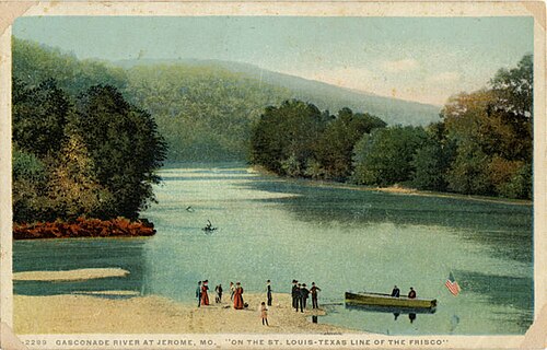
Arlington, in Phelps County, had a much better chance for a while.
It sat near the confluence of Little Piney Creek and the Gasconade River, close to Jerome and the old road corridors that later became part of the Route 66 and I-44 story.

The setting had all the ingredients that once mattered: river access, crossing routes, railroad history, and road traffic.
But transportation geography is cruel.
When newer routes and modern traffic patterns took over, Arlington shrank. It became a remnant landscape, not a bustling community.

Arlington is best described as near-abandoned or functionally abandoned rather than erased. That makes it different from a submerged town or a military-acquired settlement. There are still traces of place, but the old promise is gone.
Together, Humboldt and Arlington show the quietest kind of town death. No explosion. No poison. No dam. Just the road moving on.
More on Arlington: https://www.theroute-66.com/arlington.html
4. Old Linn Creek, Ozark Beach, and Gibson: The Towns Beneath Lake of the Ozarks

Lake of the Ozarks looks like pure recreation now.
Boats, docks, coves, lake houses, restaurants, resorts, and summer traffic dominate the story most people know. But before the lake, there was a river valley with towns, farms, roads, cemeteries, and daily life.
Old Linn Creek, Ozark Beach, and Gibson belong to that older world.
When Bagnell Dam created Lake of the Ozarks, parts of that world were cleared, flooded, or transformed beyond recognition.
Old Linn Creek

Old Linn Creek is the best-known of the submerged or displaced lake towns.
Before the lake, it served as an important community in Camden County and had county-seat significance. It was not just a cluster of cabins. It was a real town with civic identity.
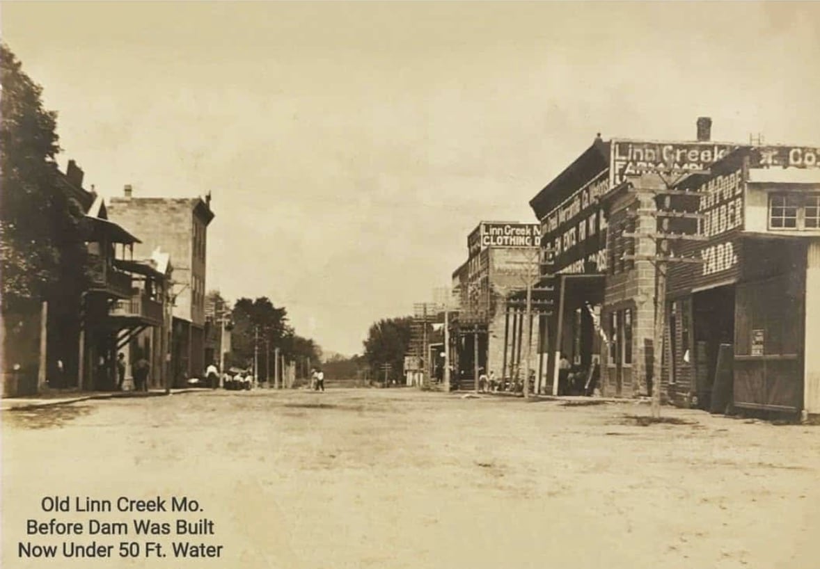
The creation of the lake ended that old version of Linn Creek.
This is the part modern visitors rarely think about. The Lake of the Ozarks was not simply “made.” It replaced something. Whole patterns of travel, trade, farming, and settlement were rewritten.
Old Linn Creek is one of the clearest reminders of that.
More on Old Linn Creek: http://www.dammingtheosage.com/old-linn-creek-before-the-flood/
Ozark Beach

Ozark Beach had more of a resort and shoreline identity, and its story sits right at the crossing point between the old river valley and the new lake economy.
It was not just erased in the simple sense. It was overtaken by a new kind of place.
The lake did not leave the region empty. It turned it into something else. That is why the abandoned-town story around Lake of the Ozarks feels different from a remote ghost town in the woods.
The old community disappeared into a busier, flashier, more profitable landscape.
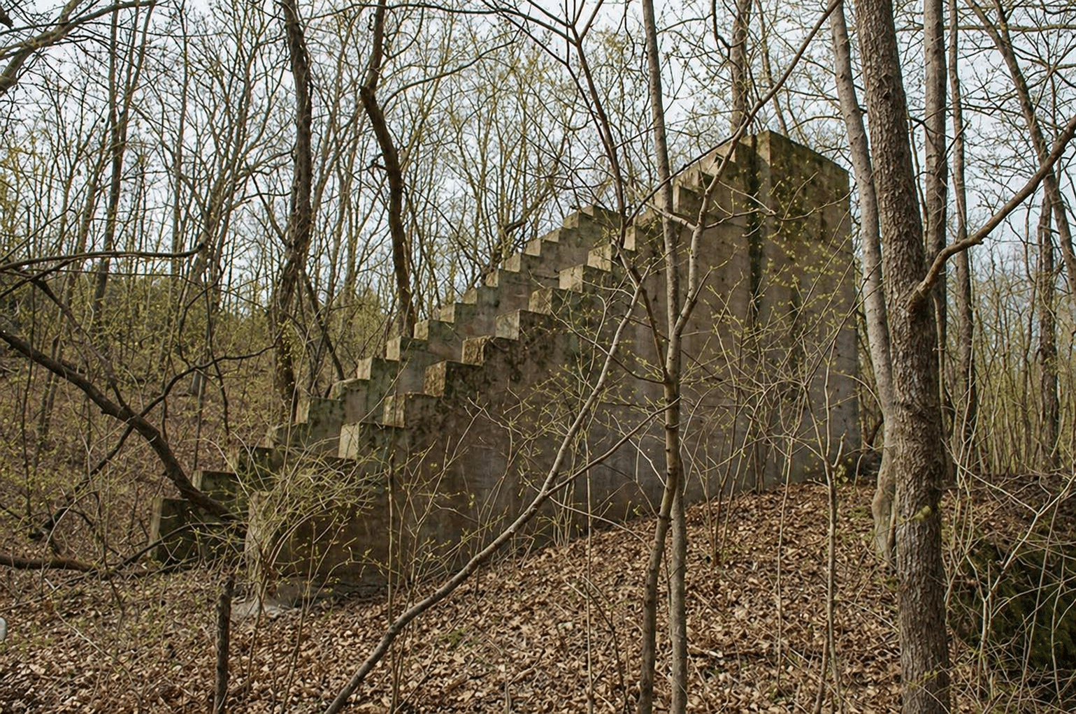
5. Far West and Adam-ondi-Ahman: The Mormon Settlements Broken by 1838

Far West and Adam-ondi-Ahman belong together because their stories are tied to one of the most intense religious and political conflicts in Missouri history.
Both were Latter-day Saint settlements. Both rose quickly. Both were broken in 1838.
Their abandonment was not caused by bad farming, a failed railroad, or a fading post office. These towns were caught in violence, expulsion, and the collapse of the Latter-day Saint presence in northwest Missouri.
Far West

Far West, in Caldwell County, was founded in 1836 and grew fast.
By 1838, it had become a major Latter-day Saint center, with a population reported around 4,000. For a brief moment, it was one of the most important communities in northwest Missouri.
Then the conflict of 1838 tore it apart.
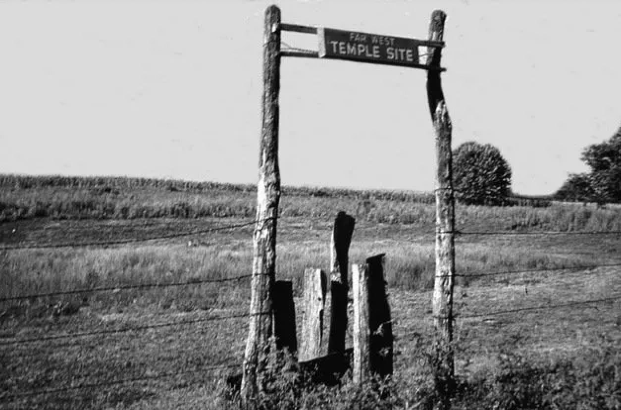
The town was abandoned as a city, but not forgotten. Today, Far West is maintained as a historic and religious site. The old town buildings are gone, but the place still carries meaning.
It is one of the rare Missouri abandoned towns where the absence feels carefully marked rather than simply lost.
Here’s more on the Mormon War and Far West, if you’re so inclined.
Adam-ondi-Ahman
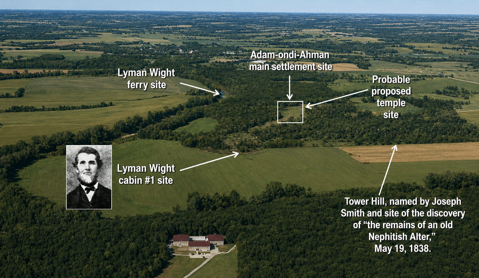
Adam-ondi-Ahman, in Daviess County, had an even shorter life as a settlement.
Established in 1838, it became deeply important in Latter-day Saint history. Like Far West, it was caught in the same wave of conflict and forced abandonment.
Today, the site is open to visitors and maintained as a sacred historic landscape. You will not find a preserved main street or old hotel. Instead, you find fields, views, paths, and markers.
That quieter setting suits the story.
6. Old Pattonsburg: The Town That Moved Uphill
Old Pattonsburg is one of Missouri’s most powerful modern abandonment stories.
This was not a town from the 1700s or a forgotten settlement buried in timber. People remember what happened.
The town began as Elm Flats in 1845 and later grew into Pattonsburg. It had the normal institutions of a small Missouri town: homes, businesses, streets, services, and a local identity.
The problem was water.
Pattonsburg sat in a flood-prone area near the Grand River and Big Creek. Flooding was part of the town’s history, but the 1993 flood changed the conversation for good.
That flood was devastating across the Midwest. In Pattonsburg, it helped push the community toward a dramatic decision: stop rebuilding in the same place.
The town moved about four miles north.
That left Old Pattonsburg behind.
This is one of the cleanest examples in Missouri of a community deciding that survival meant relocation, not repair. Many towns talk about moving out of harm’s way. Pattonsburg actually did it.
The old site is now a strange kind of ghost town. It is not ancient. It is not romantic. It is practical, muddy, and sobering.
You can still approach the old area by public roads, but much of the land is open space, floodplain, or private property. The point is not to poke through somebody’s old foundation.
The point is to understand why a town finally said, “Enough.”
7. Hamburg, Howell, and Toonerville: The Weldon Spring Towns Taken for War
The Weldon Spring area has one of the most layered histories in Missouri.
Today, many people know it for trails, prairie, the interpretive center, and the massive disposal cell tied to environmental cleanup. But before all of that, people lived there in small communities.
Hamburg, Howell, and Toonerville were among the towns displaced when the federal government acquired land in 1941 for the Weldon Spring Ordnance Works.
Like the Fort Leonard Wood towns, these places were not abandoned because they stopped mattering locally. They were removed because the federal government needed land for a national purpose.
Hamburg

Hamburg was settled by German immigrants in the 1830s.
It had the kind of long-rooted local identity that comes from farms, families, churches, roads, river connections, and decades of ordinary life. Then the government acquired the land for wartime production.
The town disappeared, but the name survived through the Hamburg Trail.
That trail name matters. Without it, many visitors would never know a community had been there at all.
Howell

Howell is less famous, which makes it important for a different reason.
History tends to remember the most documented town and let the others fade into the background. But Howell represented real homes, real farms, and real families.
For the people who lived there, Howell was not a supporting character in Hamburg’s story. It was home.
Toonerville
Toonerville may have the most memorable name of the three, but like Howell, it is best understood as part of the broader Weldon Spring displacement.
The old community was absorbed into a wartime industrial landscape. Later, that same area became tied to Cold War-era work and environmental cleanup.
That means the land has been rewritten more than once.
Farm community. Ordnance works. Cleanup site. Public interpretive landscape.
The Weldon Spring towns remind us that abandoned places do not always become empty. Sometimes they become something so different that the original community is almost impossible to picture.
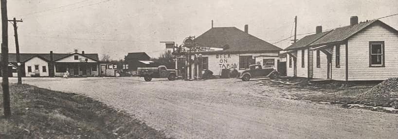
8. Seventy-Six: The River Town With a Name Nobody Forgets

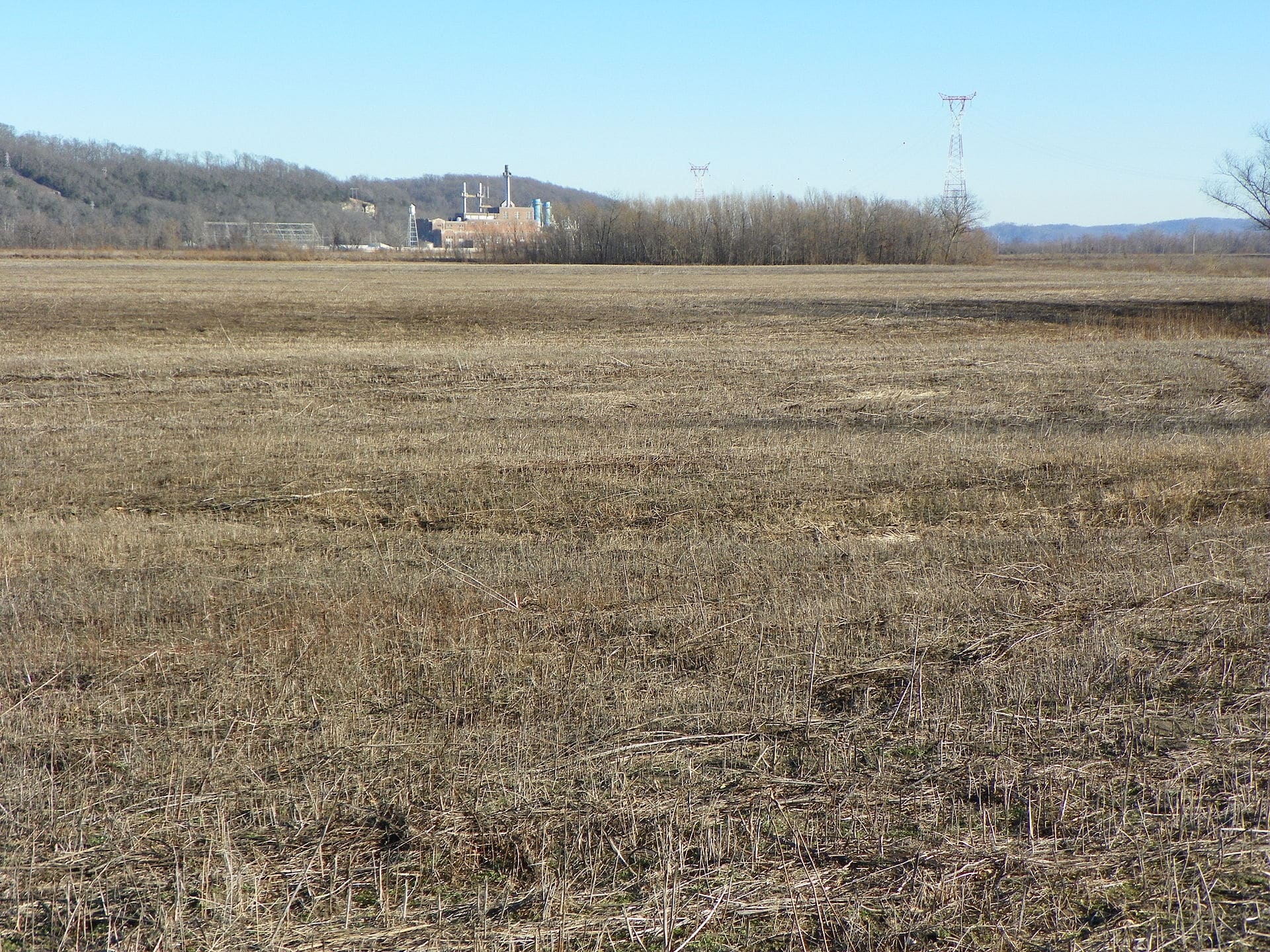
Located in Perry County along the Mississippi River, Seventy-Six was once a river landing community with a post office, schools, a store, a hotel, grain and wood trade, church life, a stockyard, and later a rail stop.
That is a lot of life packed into a place many Missourians have never heard of.
River towns lived by movement. Boats, cargo, timber, grain, livestock, and people gave them a reason to exist. But river towns also lived with risk.
The Mississippi could build a town’s economy, then turn around and batter it with floods, shifting trade routes, and changing transportation patterns.
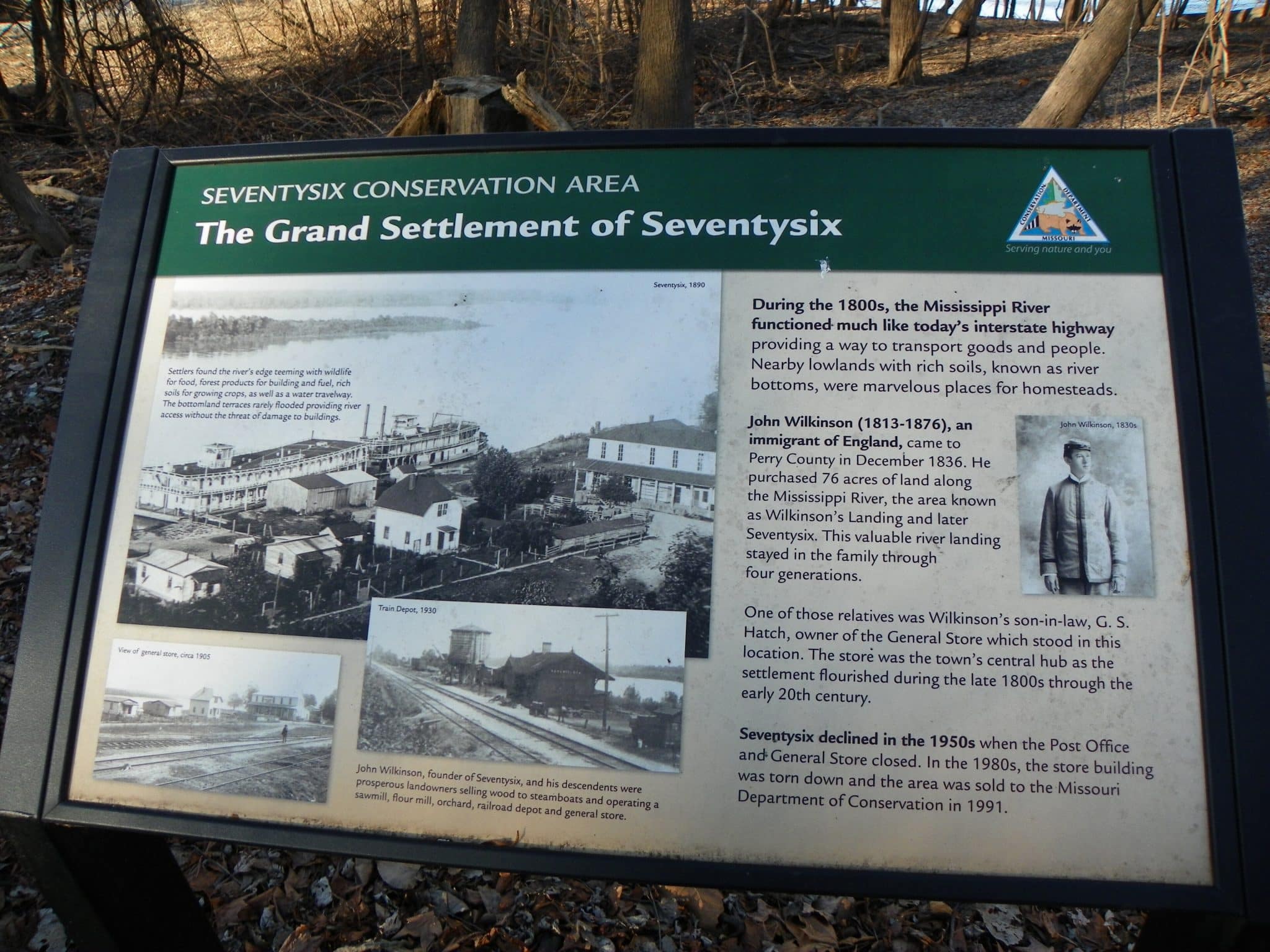
By 1940, Seventy-Six had only 35 people.
Eventually, it faded as a living town. The name remained, attached to Seventy-Six Conservation Area.
That makes it one of the more accessible vanished-town landscapes in Missouri. You can visit the conservation area and stand near the place where river commerce once gave the town its heartbeat.
There may not be much left in the classic ghost-town sense. But with Seventy-Six, the river is the main artifact.
It explains why the town was born and why it died.
More on the town: https://www.capecentralhigh.com/cape-photos/seventysix-the-town-not-the-trombones/
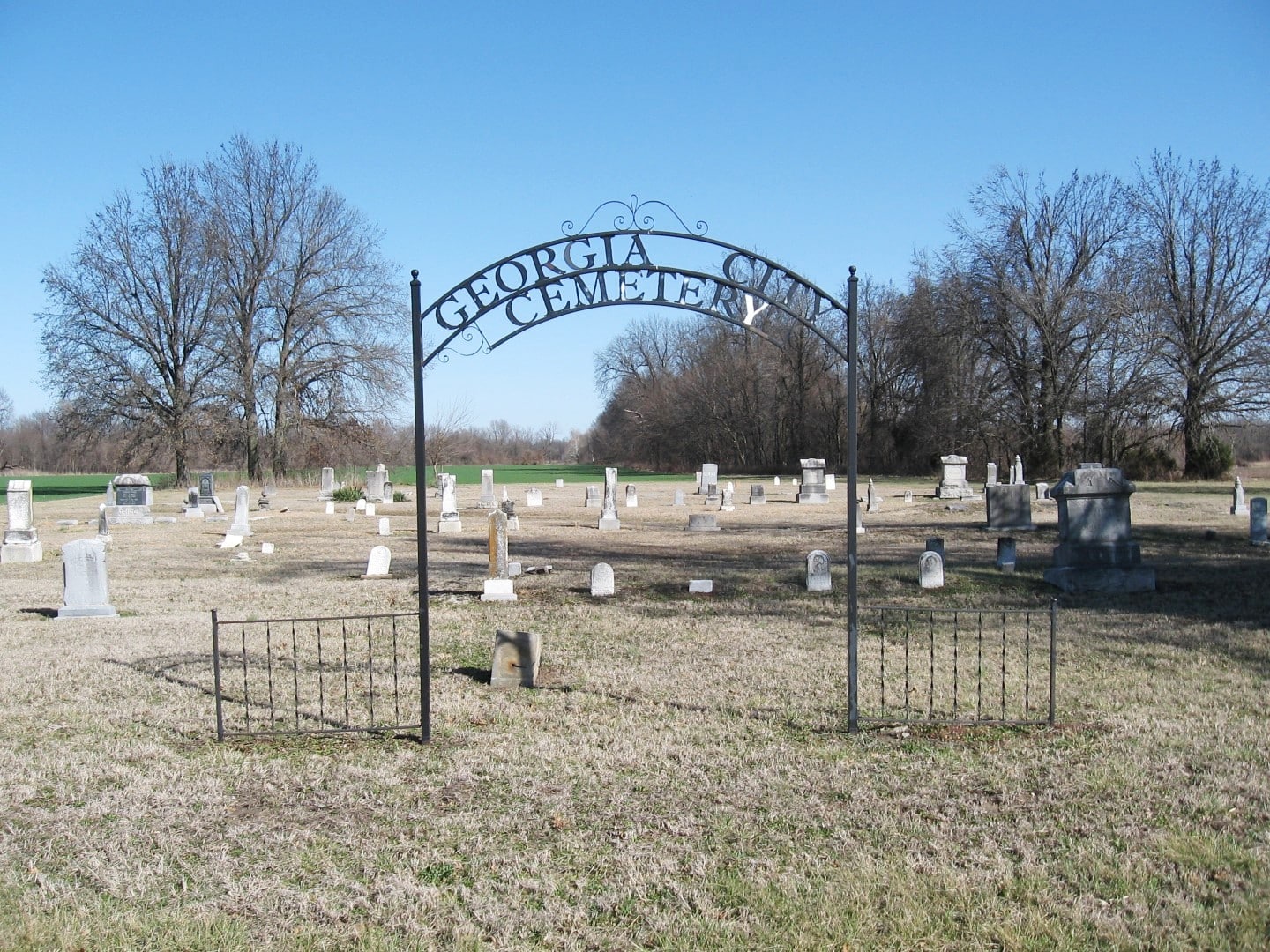
9. Georgia City: The Town That Was Officially Unmade
Georgia City has one of the cleanest rise-and-fall stories on the list.
Founded in Jasper County in 1868, it grew quickly enough to reach about 200 people by March 1869. For a brand-new town, that was a promising start.
Then the promise slipped away.
By 1883, the population had fallen to about 50. The post office and town activity faded. Farms took over again. Eventually, in 1930, the town plat was formally vacated.
That last detail makes Georgia City special.
Many abandoned towns die informally. People leave, buildings fall, roads fade, and the place disappears from daily use. Georgia City was not only abandoned in practice. It was officially erased as a platted town.
The land went back to being farm ground.
Today, Georgia City Cemetery is the most important visible reminder. That is common with vanished towns. Cemeteries often outlast stores, schools, homes, bridges, and even roads.
A cemetery can keep a town’s name alive long after the town itself is gone.
Georgia City is not a place for stomping across private fields. County roads bring you into the area, and the cemetery is the respectful landmark.
The real story is the paper town that became farmland again.
10. Monegaw Springs: The Resort Town That Couldn’t Recover
Monegaw Springs had something many small Missouri towns never had: a resort identity.
Located in St. Clair County, the area was known for mineral springs and tourism. In the 1800s and early 1900s, mineral springs drew people who believed the waters could restore health, ease pain, or simply provide a pleasant escape.
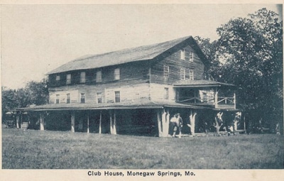
Monegaw Springs had hotels, clubs, visitors, and a reputation.
Then the hotel burned in 1927.
That fire badly damaged the town’s future. Without the resort economy, Monegaw Springs lost the thing that made it stand out.
It is one of the best Missouri examples of a town built around a single draw. If that draw survives, the town may keep going. If it fails, the town can shrink fast.
Today, Monegaw Springs is best described carefully as largely uninhabited. Some modern references still treat it as an unincorporated place, so it is not quite the same as a town wiped off the map.
Still, the old resort dream is gone.
That is what makes it interesting. You can almost see the vanished porch chairs, hotel guests, mineral-water promises, and proud little tourist economy that once made the place feel like it had a future.
This is one of the more interesting towns to read more about on this list: https://www.tipcoleman.com/
What You Can Actually See Today
A good abandoned-town story should be honest about what remains.
Some of these places are public and fairly easy to understand on the ground. Seventy-Six Conservation Area, the Weldon Spring landscape, Far West, and Adam-ondi-Ahman are among the more visitable sites.
Some are restricted. The Fort Leonard Wood towns are inside an active military installation.
Some are submerged or tied to lake access. The Lake of the Ozarks towns are not simple roadside stops.
Some are mostly private land. Georgia City, Humboldt, and parts of Old Pattonsburg require caution and respect.
That does not make them less interesting. It may make them more interesting.
A town does not need standing buildings to leave a mark. Sometimes a cemetery is enough. Sometimes a trail name is enough. Sometimes a lake cove, a military map, or an empty floodplain tells the story.
Missouri is full of those places.
You just have to know what used to be there.